Hello, my name is Suzette King. I am a Masters student in GIS at the University of Leeds and I am interested in GIS web development, GIS & Data Analytics and Remote Sensing.
I have created this website to showcase my GIS, Data and Programming skills developed during my studies.
My Portfolio which is summarised on the right can be explored by selecting the relevant button below:
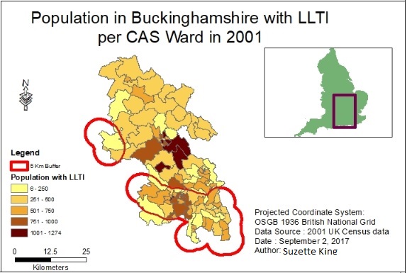
In this project, I investigated whether there is a link between proximity to motorways and the
rates of LLTI in the county of Buckinghamshire, UK, using the 2001 census data
Using Census data
Vector Analysis
ArcGIS 10
Areal Interpolation
Model Builder
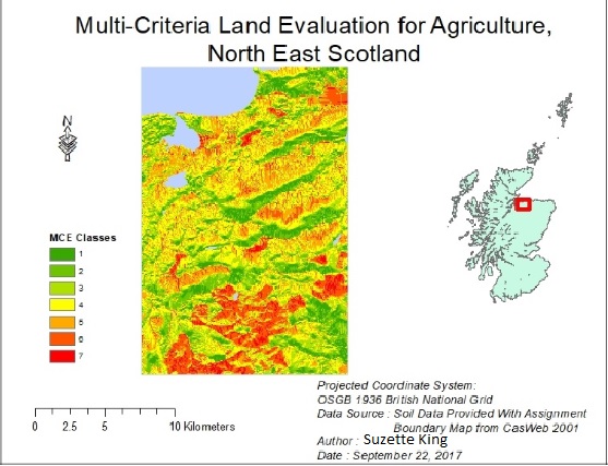
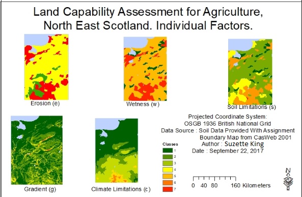
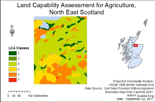
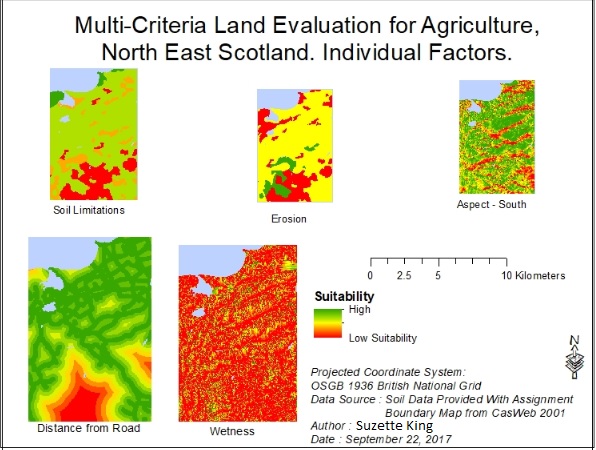
In this project, I compared and contrasted the results of conducting a Land Classification using two methods, namely British Land Capability Assessment (LCA) and the Multi-Criteria Evaluation (MCE)
Skills UtilisedRaster processsing and analysis Raster Algebra
ArcGIS 10
An Investigation into the link between proximity to Motorway and the rate of LLTI(Limiting Long Term Illness) in Buckinghamshire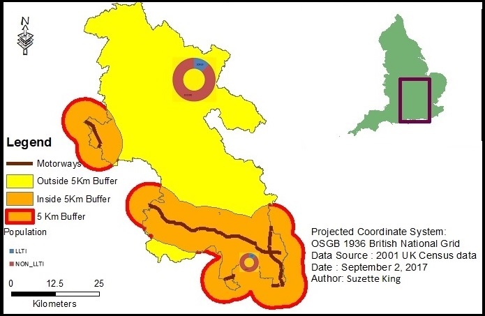
|
Creating a Land Capability Map using two methodology - British Land Capability Assessment (LCA) and Multi Criteria Evaluation (MCE)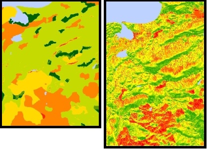
|
Crime Analysis - Identify Burglary Hot-spots in Leeds, UK, using various techniques such as Point Based Map, Choropleth Map, Kernel Density, Getis-Ord GI* and GAM (Geographical Analysis Machine)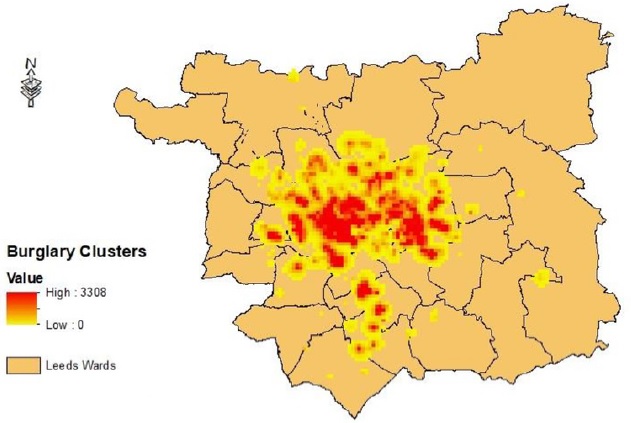
|
Python Programming - Agent Based Modelling Using Matplotlib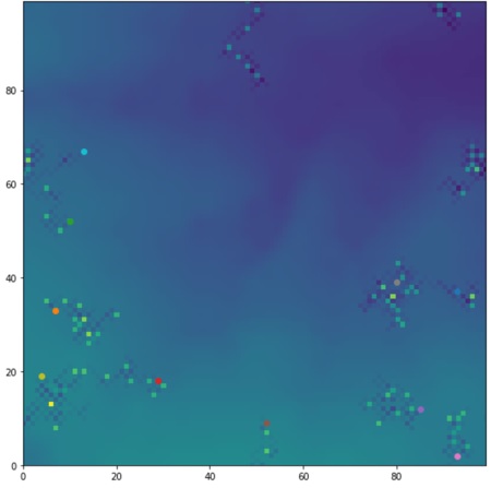
|
Python Programming - Black Death using Matplotlib, Numpy, etc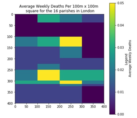
|
Agent Based Modelling - Agents are often used to model geographic systems. In this example an application is created to represent the movement of people during a building evacuation and how this is impacted by the placement of a pillar close to the exit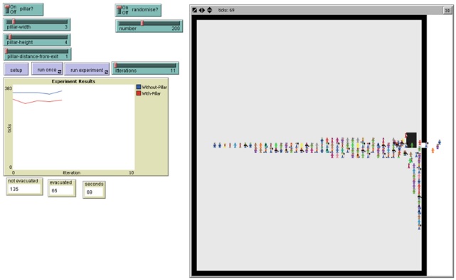
|
GIS Web Development using GoogleMap API - Blue Plaques In Leeds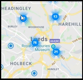
|
GIS Web Development using Leaflet API - United Kingdom Accidents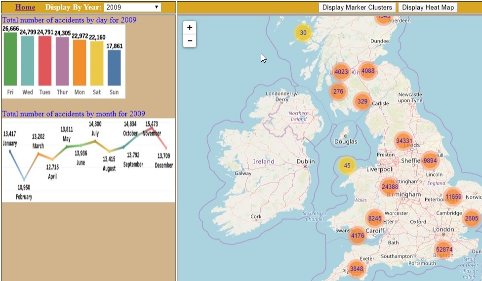
|
Dissertation - Creating an Urban Tree Inventory / Tree Map by Using OpenCV to detect individual trees in LiDAR Point Cloud Data. |
|
|
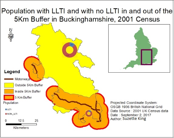
The tasks to complete this project involved joining census data to boundary data and creating a 5km buffer of the motorways running through the county of Buckinghamshire.
An areal interpolation is then used to calculate the percentages of people with a LLTI and with no LLTI inside and outside the buffer
A major issue encountered was that this methodology assumed there was a homogeneous distribution of population within each census ward which is not the case so an area based areal interpolation was then conducted to recalculate the geometry of the census ward and the population totals in the newly calculated area. This calculation returned a difference of 0.17% of LLTI inside the buffer compared to a LLTI outside the buffer which was not enough to conclude if there is a link between the rates of LLTI with proximity to motorways
|
|
|
|
The tasks to complete this project involved
